
Question: How to remove the black edges of images in ArcGIS? Introduction: Black borders are a common problem in images in ArcGIS, affecting the appearance and accuracy. This article introduces in detail the techniques for removing black edges from images in ArcGIS to help everyone solve this problem. Guidance: Continue reading below to learn about the step-by-step guide to removing black edges from images in ArcGIS, including adjusting data ranges, using cropping tools, and geoprocessing tools. With these tips, you can effectively remove black edges from your images and get clear and accurate images.
First, open arcgis software.

Then, use the Add button to load the image.
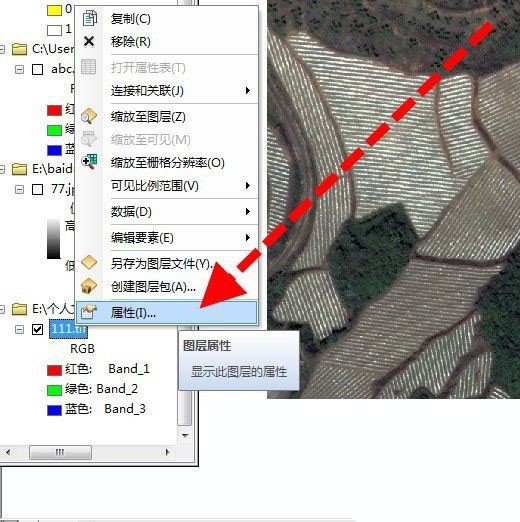
Then, right-click the properties of the image.
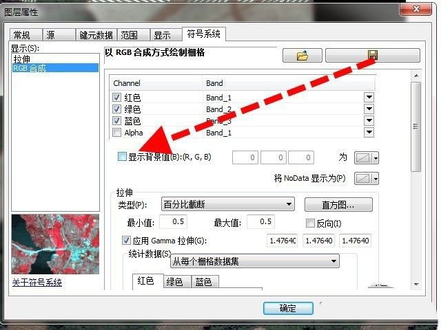
In the properties window, find the display background value and tick it in front.
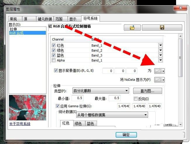
Set the next three values to 0 after the display background value.
Finally, click OK to return to the main interface, and the black edges of the image are successfully removed.
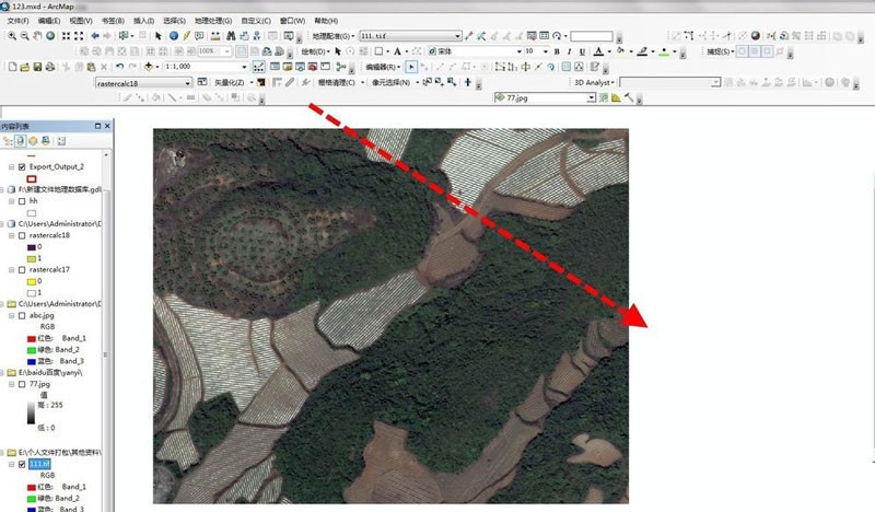
Note: This method only hides the black edges when displayed, and the actual data is still 0.
The above is the detailed content of How to remove black edges in arcgis Arcgis image black edge processing techniques. For more information, please follow other related articles on the PHP Chinese website!


