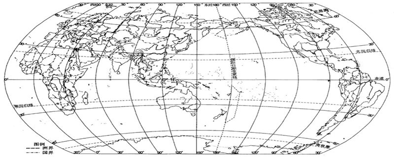

Horizontal lines represent latitude lines, and vertical lines represent longitude lines, marking the east-west longitude and north-south latitude, forming a latitude and longitude network. (Recommended learning: web front-end video tutorial)
First find the position of the meridian (also the position of 0 degrees of longitude), and then follow the geographical coordinates - up, north, down and south , the rule of left west and right east is drawn on the map according to the longitude and latitude lines.
The latitude and longitude network refers to the intertwined network of longitude and latitude lines on a globe or map.
On a globe or map, longitude and latitude lines are intertwined to form a latitude and longitude network.
Using the longitude and latitude marked on it, various locations, regions and various geographical locations on the earth's surface can be determined. It is very useful in military, aviation, navigation and other aspects.
For example, ships sail on the vast sea, and airplanes fly in the vast sky. No matter where they go, people can use instruments to accurately measure its longitude and latitude, thereby determining its location.
On maps and globes, we can see thin lines one by one, some horizontal and some vertical, much like the square grid on a chessboard. These are the longitude and latitude lines. Based on these longitude and latitude lines, the position and direction of any place on the ground can be accurately determined.
How are these longitude and latitude lines determined?
The earth is constantly rotating around the earth’s axis (the earth’s axis is an imaginary line passing through the earth’s north and south poles and the center of the earth). Draw a large circle perpendicular to the earth’s axis in the middle of the earth, so that the circle Every point is equidistant from the North and South Poles, and this circle is called the "equator."
On the north and south sides of the equator, draw many circles parallel to the equator, which are "latitude circles"; the line segments that make up these circles are called latitude lines.
is defined as the angle between a line connecting a point on the earth to the center of the sphere and the equatorial plane.
We define the equator as zero degrees of latitude, and 90 degrees to the south and north. Those south of the equator are called southern latitudes, and those north of the equator are called northern latitudes. The North Pole is 90 degrees north latitude, and the South Pole is 90 degrees south latitude. The height of latitude also marks the hot and cold climate. For example, there is no winter in the equator and low latitudes, no summer in the poles and high latitudes, and four distinct seasons in the mid-latitudes.
The above is the detailed content of How to draw a latitude and longitude network diagram. For more information, please follow other related articles on the PHP Chinese website!